Recently Garmin have released an outdoor handheld device which included the L5 GNSS signal capability called the Garmin GPSMAP 66sr. This is one of the first commercially available consumer devices which includes the L5 signals so we thought we would see if we could demonstrate the advantages of L5 signals.
L5 signals are a new generation of signals on the 1146.45MHz frequency and are available for civilian use. As the L5 Band is the furthest away from the L1 signal of GPS (1575.42) the receiver can mitigate the effects of the atmosphere on the signal. This variable slowing down of the signal transmission from space is the largest single cause of GNSS device position error. It mitigates this effect by the fact that both signals leave the satellite at the same time and position and the receiver can compare and remove the error.
The L5 signals improve the accuracy of the receiver and have for example the advantage of being visible worldwide with the satellite rather than SBAS corrections which being on a satellite only over the equator often suffer from obscuration in valleys, urban canyons etc.
We wanted to see what effect the L5 signal would have on multipath and higher elevation mask angles as if the signal was denied in high sided mountain valleys and urban canyons.
Multipath
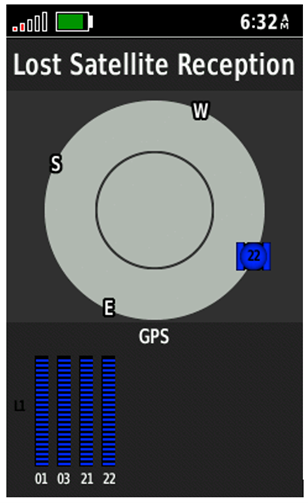
In the outdoors there is not much multipath, so we went to Canary wharf in East London for a drive with the Garmin GPSmap 66sr handheld device on board. This area is a known high multipath area.
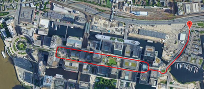
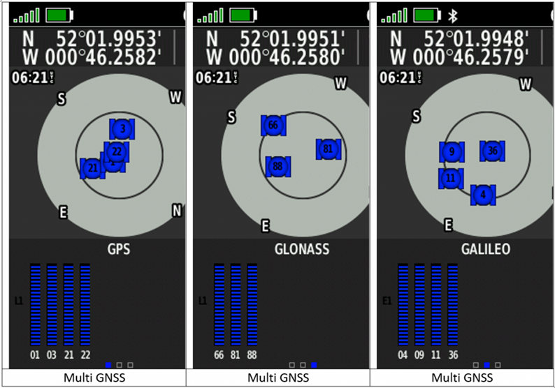
The start position was used to allow the device to gain good satellite lock. Three drives of three circuits were taken with the device set at multi band (L5) & Multi GNSS. Multi GNSS& GPS only.
The results are as follows:
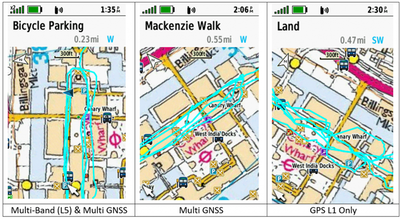
The L5 signals with multiple constellations produce by far the best results. The Multi GNSS increases the number of satellites available even in poor visibility situations to show significant improvement over GPS only. Please note that GPS only results are mitigated in a Sat Nav by a technique called map matching to show consistent results on the Nav screen.
This simple test shows the excellent performance of the Multi GNSS and Multi-Band (L1 & L5). GPS has fifteen satellites with L5 available and Galileo with 24 all of which are currently using L5. In good satellite visibility the device will show a 6Ft accuracy with Multi GNSS and Multi-Band and 10ft with GPS only. This represents a 40% gain in accuracy which if maintained in all conditions is very useful in the outdoors.
Obscuration (High Elevation Mask Angle)
As our military forces found out in Afghanistan. The very high mountains have a detrimental effect in GNSS receiver performance. Not only do high mountain sides in valleys obscure most of the available satellites. They increase the positional error. In other words, the DOP increases so the mathematical calculations in the receiver are not accurate.
Testing this phenomenon in a flat country like the UK presents a challenge in any situation but Covid just makes it impossible to travel to high mountains.
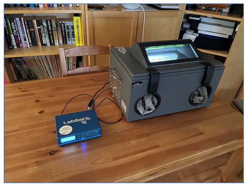
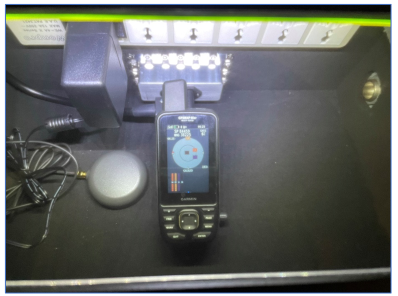
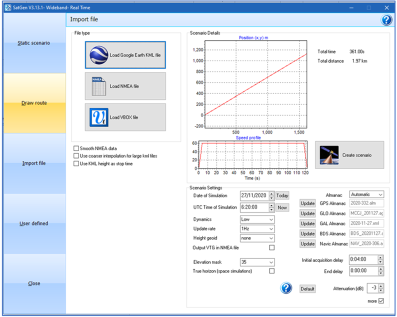
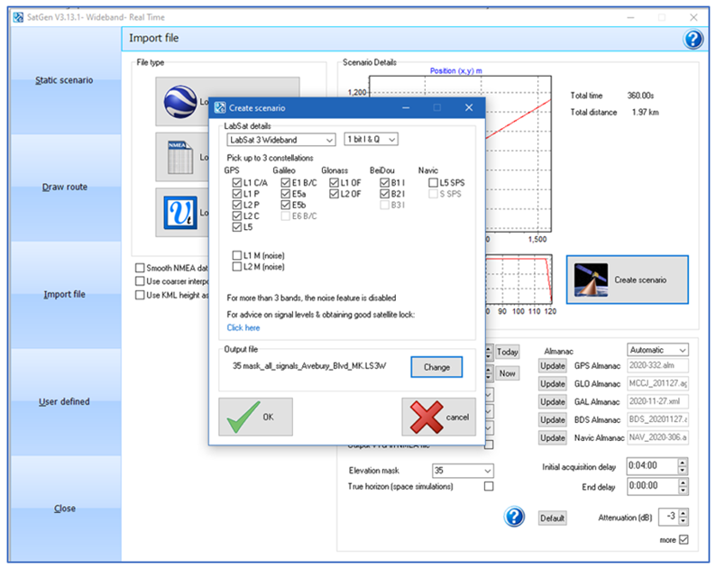
LabSat has the answer. By using SatGen software to recreate the various signals with variable elevation mask angles we can simulate high mountain valleys. By placing the GPSMAP 66sr in the LabSat GNSS Test Enclosure we can ensure that only the test signals are used. With a LabSat 3 Wideband system to replay the signals, we can replicate the harsh terrain of the mountain valleys.
We have created a 20 minute scenario (file) at a fixed point with all signals including L5 for GPS and Galileo.
Here are the results:
You can see the success of the SatGen all signals scenario with a 35 degree elevation mask angle. The device still claims 6ft accuracy.
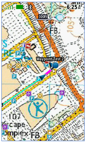
We will demonstrate how the accuracy is degraded with a high elevation mask angle on the GPSMAP 66sr receiver. We have created two waypoints in the centre of Milton Keynes at either end of Avebury boulevard. The route is a direct line between the two points.
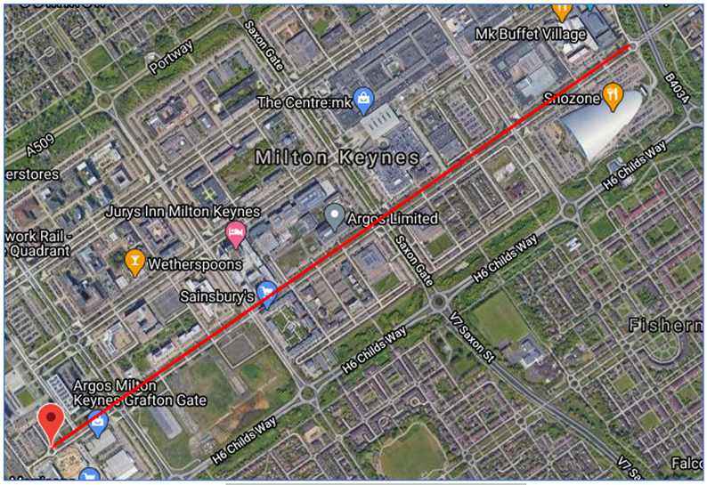
By using SatGen software we can create a short scenario of all signals with a 35 degree mask angle. Using Trimble Online Planning we can see that 35 degree mask angle is the highest angle we can use with four satellite visible for GPS, GLONASS and Galileo constellations.
We can use the software to create an all signals scenario over Milton Keynes.
We conducted three tests with the SatGen all signals 35 degree elevation mask angle over the short 2 km route using the LabSat Test Enclosure.
- GPS only
- Multi GNSS
By setting the waypoints into the device and using the different satellite setting we can test the relative performance.
GPS Only:
The GPS only setting with the 35 degree mask angle would not acquire a lock at all on both the Garmin and ublox receivers.
Multi GNSS:
With Multi GNSS we are able to acquire a position and travel along the route. However, we see a significant offset.
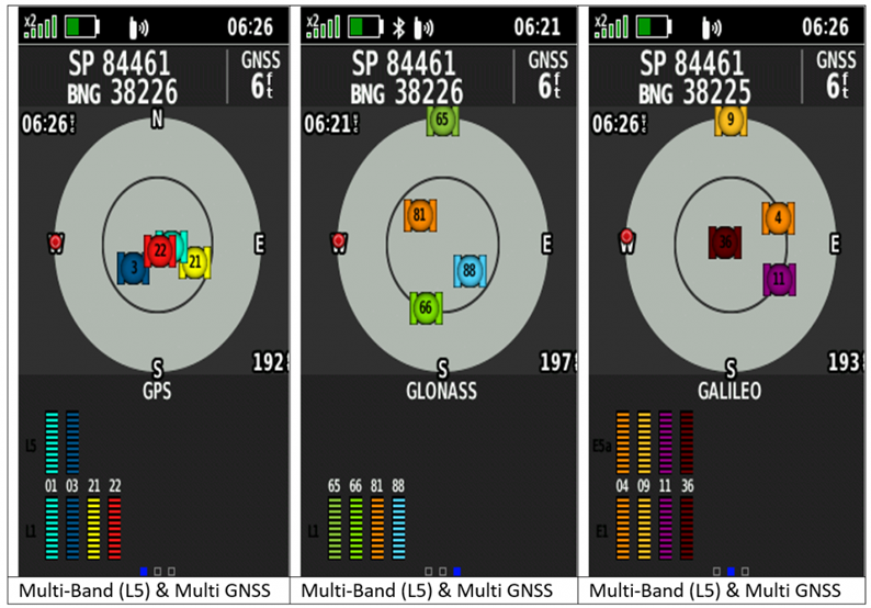
Multi-Band (L5) & Multi GNSS:
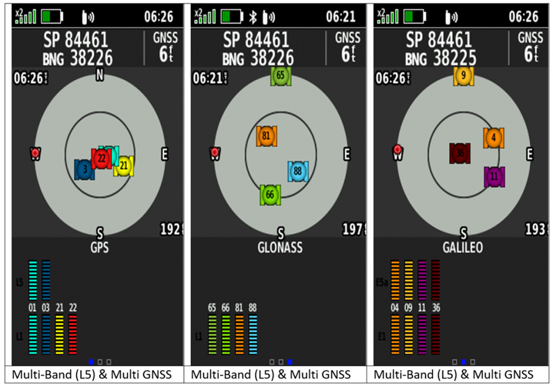
The performance of the Multi-Band (L5) & Multi GNSS is impressive with the route being followed exactly with the direct line between to two waypoints.
Conclusion
In both situations the use of Multi-Band (L5) & Multi GNSS significantly improves the accuracy of the receiver. The situations of multipath and obscuration used in these tests are at the extreme of GNSS performance and show that L5 signals improve accuracy significantly and the use of Multi GNSS allows for a good performance without the higher accuracy.
Considering that the L5 signals are available on four Galileo and two GPS satellites this performance is impressive. With more GPS satellites being launched with L5 and a full constellation available by 2025/25 and combined with the new L1c signal the future performance of GNSS will only improve.
End