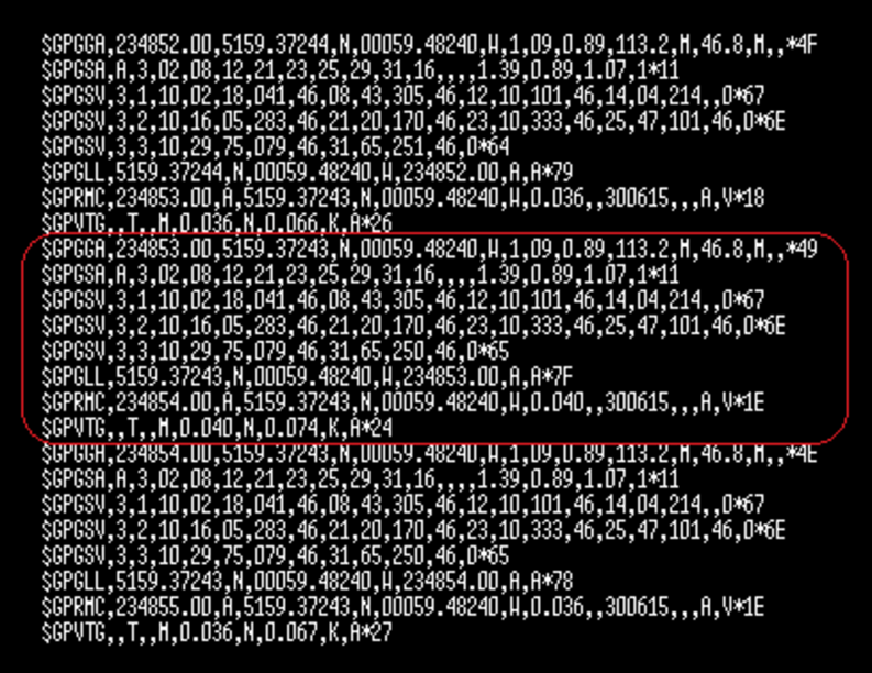
LabSat 3 users can monitor the NMEA output, alongside the RF during replay. The NMEA output is available via the USB port on the rear of the LabSat 3, connecting to a PC will allow the output to be viewed in a terminal program.
The NMEA output from LabSat 3 will resemble the screenshot below. Highlighted within the red square is an individual packet of the NMEA string.
GGA NMEA Format Definition
$GPGGA,hhmmss.ss,llll.ll,a,yyyyy.yy,a,x,xx,x.x,x.x,M,x.x,M,x.x,xxxx*hh
| 1 | = | UTC of Position |
| 2 | = | Latitude |
| 3 | = | N or S |
| 4 | = | Longitude |
| 5 | = | E or W |
| 6 | = | GPS quality indicator (0=invalid; 1=GPS fix; 2=Diff. GPS fix) |
| 7 | = | Number of satellites in use [not those in view] |
| 8 | = | Horizontal dilution of position |
| 9 | = | Antenna altitude above/below mean sea level (geoid) |
| 10 | = | Meters (Antenna height unit) |
| 11 | = | Geoidal separation (Diff. between WGS-84 earth ellipsoid and mean sea level. -=geoid is below WGS-84 ellipsoid) |
| 12 | = | Meters (Units of geoidal separation) |
| 13 | = | Age in seconds since last update from diff. reference station |
| 14 | = | Diff. reference station ID# |
| 15 | = | Checksum |
GSA NMEA Format Definition
$GPGSA,A,3,,,,,,16,18,,22,24,,,3.6,2.1,2.2*3C
$GPGSA,A,3,19,28,14,18,27,22,31,39,,,,,1.7,1.0,1.3*35
| 1 | = | Mode: M=Manual, forced to operate in 2D or 3D A=Automatic, 3D/2D |
| 2 | = | Mode: 1=Fix not available 2=2D 3=3D |
| 3-14 | = | IDs of SVs used in position fix (null for unused fields) |
| 15 | = | PDOP |
| 16 | = | HDOP |
| 17 | = | VDOP |
GSV NMEA Format Definition
$GPGSV,3,1,11,03,03,111,00,04,15,270,00,06,01,010,00,13,06,292,00*74
$GPGSV,3,2,11,14,25,170,00,16,57,208,39,18,67,296,40,19,40,246,00*74
$GPGSV,3,3,11,22,42,067,42,24,14,311,43,27,05,244,00,,,,*4D
$GPGSV,1,1,13,02,02,213,,03,-3,000,,11,00,121,,14,13,172,05*67
| 1 | = | Total number of messages of this type in this cycle |
| 2 | = | Message number |
| 3 | = | Total number of SVs in view |
| 4 | = | SV PRN number |
| 5 | = | Elevation in degrees, 90 maximum |
| 6 | = | Azimuth, degrees from true north, 000 to 359 |
| 7 | = | SNR, 00-99 dB (null when not tracking) |
| 8-11 | = | Information about second SV, same as field 4-7 |
| 12-15 | = | Information about third SV, same as field 4-7 |
| 16-19 | = | Information about fourth SV, same as field 4-7 |
GLL NMEA Format Definition
$GPGLL,3751.65,S,14507.36,E*77
$GPGLL,4916.45,N,12311.12,W,225444,A
| 4916.46,N | Latitude 49 deg. 16.45 min. North |
| 12311.12,W | Longitude 123 deg. 11.12 min. West |
| 225444 | Fix taken at 22:54:44 UTC |
| A | Data valid |
$GPGLL,5133.81,N,00042.25,W*75
1 2 3 4 5
| 1 | = | 5133.81 | Current latitude |
| 2 | = | N | North/South |
| 3 | = | 00042.25 | Current longitude |
| 4 | = | W | East/West |
| 5 | = | *75 | Checksum |
RMC NMEA Format Definition
$GPRMC,081836,A,3751.65,S,14507.36,E,000.0,360.0,130998,011.3,E*62
$GPRMC,225446,A,4916.45,N,12311.12,W,000.5,054.7,191194,020.3,E*68
| 225446 | Time of fix 22:54:46 UTC |
| A | Navigation receiver warning A = OK, V = warning |
| 4916.45,N | Latitude 49 deg. 16.45 min North |
| 12311.12,W | Longitude 123 deg. 11.12 min West |
| 000.5 | Speed over ground, Knots |
| 054.7 | Course Made Good, True |
| 191194 | Date of fix 19 November 1994 |
| 020.3,E | Magnetic variation 20.3 deg East |
| *68 | Mandatory checksum |
$GPRMC,220516,A,5133.82,N,00042.24,W,173.8,231.8,130694,004.2,W*70
1 2 3 4 5 6 7 8 9 10 11 12
| 1 | = | 220516 | Time Stamp |
| 2 | = | A | Validity – A-ok, V-invalid |
| 3 | = | 5133.82 | Current Latitude |
| 4 | = | N | North/South |
| 5 | = | 00042.24 | Current Longitude |
| 6 | = | W | East/West |
| 7 | = | 173.8 | Speed in knots |
| 8 | = | 231.8 | True course |
| 9 | = | 130694 | Date Stamp |
| 10 | = | 004.2 | Variation |
| 11 | = | W | East/West |
| 12 | = | *70 | Checksum |
$GPRMC,hhmmss.ss,A,llll.ll,a,yyyyy.yy,a,x.x,x.x,ddmmyy,x.x,a*hh
| 1 | = | UTC of position fix |
| 2 | = | Data status (V=navigation receiver warning) |
| 3 | = | Latitude of fix |
| 4 | = | N or S |
| 5 | = | Longitude of fix |
| 6 | = | E or W |
| 7 | = | Speed over ground in knots |
| 8 | = | Track made good in degrees True |
| 9 | = | UT date |
| 10 | = | Magnetic variation degrees (Easterly var. subtracts from true course) |
| 11 | = | E or W |
| 12 | = | Checksum |
VTG NMEA Format Definition
$GPVTG,360.0,T,348.7,M,000.0,N,000.0,K*43
$GPVTG,054.7,T,034.4,M,005.5,N,010.2,K
| 054.7,T | True track made good |
| 034.4,M | Magnetic track made good |
| 005.5,N | Ground speed, knots |
| 010.2,K | Ground speed, Kilometers per hour |
$GPVTG,t,T,,,s.ss,N,s.ss,K*hh
| 1 | = | Track made good |
| 2 | = | Fixed text ‘T’ indicates that track made good is relative to true north |
| 3 | = | not used |
| 4 | = | not used |
| 5 | = | Speed over ground in knots |
| 6 | = | Fixed text ‘N’ indicates that speed over ground in in knots |
| 7 | = | Speed over ground in kilometers/hour |
| 8 | = | Fixed text ‘K’ indicates that speed over ground is in kilometers/hour |
| 9 | = | Checksum |